


Apple cars, mapping Monaco
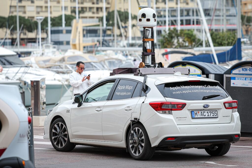
The vehicles are part of an Apple data collection campaign - © Communication Department / Stéphane Danna
On 28 and 29 February, two Apple vehicles toured the Principality as part of an update to the brand’s “Maps” application.
Perhaps you spotted the white Subarus, with an unusual object on the roof? The cars, and more specifically their cameras, were collecting “new data to keep our high-quality maps up to date,” said the firm.


Advertising
On the camera side, Apple uses a tool consisting of twelve cameras and LIDAR or “Laser Imaging Detection and Ranging” sensors. The technology provides an accurate reconstruction of the environment. In layperson’s terms, the telemetry method involves pointing a laser at a surface, and the device then calculates the time it takes for the laser to return to its source.
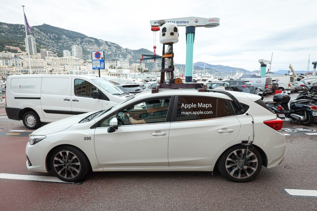
Apple has been conducting these field surveys around the world since 2015 – © Communication Department / Stéphane Danna
The data will be used to improve its 360° view “Look Around” feature, which allows users to “take a virtual walk around the streets” in certain towns and cities. In terms of privacy, the multinational claims that “no faces or number plates will be identifiable on the images published in the 360° view.” These are blurred in the application.